

After returning home from our road trip through the midwest for two weeks, we were eager to get back into the mountains for a Colorado high elevation hike. James Peak was an easy choice for a Sunday morning hike; it's close to the Denver area and the route takes you to the top of a Glacier and then across a lush, high elevation prairie before starting the summit to the peak. This trail is particularly beautiful in mid July when the wildflowers are at their peak blooming season, plus the glacier and snow makes the hike a little cooler in the summer Colorado heat.
Getting there: from the Denver area, take I-70 west just past Idaho Springs until you reach exit #238 for St. Marys Glacier. Continue straight to Fall River Road which is well marked, for 10 miles until you reach the trailhead. Parking is tricky here, there are two small privately owned parking lots on the private land, it costs 5 dollars per day to park, there is a port o pot in the lot, and camping is permitted. If parking lots are full, you can park alongside the road and take your chances at getting towed, there are numerous no parking signs. Here is a link to the location on a google map, note the address for getting your own personal directions. The hike is 7 miles round trip to reach the summit.
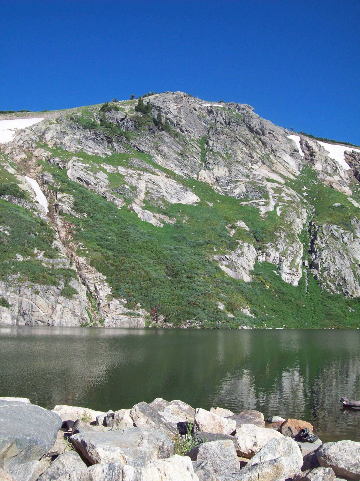 |
| St. Mary's Glacier Lake |
Josh and I arrived at the trailhead early to ensure we'd get a parking spot and we wanted to come home early and get some work done on Sunday. When we arrived at the lot before 8am, the parking lot was already half full. The hike starts in the pine trees on a rocky trail which takes the hiker to the base of St. Mary's Glacier and lake. This portion of the trail is heavily used for day hikes to view the glacier, and there are several off-shoot trails through the woods which can be confusing, but all of them lead to the base of the gladier and lake. When we reached the lake, back country campers were cooking breakfast over a campfire; what a great location for camping!
The area is very lush by Colorado standards with lots of wildflowers, flowing creeks from the glacier, small waterfalls and green grass. Continue to hike past the lake and up the north or right (less steep) side of the snowy glacier. We had a slow time hiking up the snow without our hiking poles (or crampons) and there were a few times when we slipped and fell. The dogs loved playing in the snow and it was hard to stop Belle from chasing after the sledders.
As we neared the top of the glacier, we noticed a trail on the left/south side of the glacier above the snow; we crossed the snowfield to walk on the ground and it was much easier than hiking on the snow. Once you reach the top of the glacier the snow abruptly ends and you are standing on a lush, high altitude prairie at over 11,000 feet. From here you can see James Peak straight ahead in the distance. Continue on the trail across the meadow until you reach the 4x4 wheel drive road; from here you can go either way on the road to summit the mountain from both the north and south sides. Both trails take the hiker slightly out of the way by going more north or south before cutting across the meadow to the mountain and the trails converge high on the mountain near the summit. On the hike up, we went north and walked down the 4x4 road for at least a half mile until we reached the trail that cut across toward the peak.
 |
| Ice Lake in the center of photo, approx 12,200ft |
I love nature photography, and the lush meadows, streams, mountain runoff, thick grass and wildflowers were a photographers dream! I snapped photos left and right, the dogs were able to play and drink in the rivers and streams as we slowly reached the base of the summit. Once on the rocks of this peak, there were still numerous flowers and streams that flowed below out feet under the rocks and surfaced from time to time for the dogs to get a drink. The views from up on the rocks were amazing, eventually the trail snakes around the south side of the mountain and connects with the more southern trail route. From here, take the small side jaunt and walk over to the edge of the mountain for incredible views of high altitude lakes like Ice Lake, which still had a thick layer of ice even in late July. There are 5 other high altitude lakes ending in Loch Lomond which you can also see. There are numerous waterfalls connecting the lakes and the short jaunt is worth the incredible views. There is a trailhead at Loch Lomond and you may see several cars, backpackers, tents and hikers down in the distance.
 |
| Sunflowers in high altitude meadow |
Near the end of the hike to the top, I started to get really achy in my hips and the high elevation was getting to me, but the views at 13,000 feet are so incredible that it helps the pain to go away. The trail snakes back to the north side of the mountain and you get to see amazing views on the sheer rock cliffs to view James Peak Lake and Little Echo Lake in the distance.
We came up over the top of the peak around 12:30pm and even though it was a hot day, the wind from being on the top was chilly and it took just a few minutes before I got cold. We ate some lunch, snapped some photos and checked out the 360 degree views from the top before we started our descent. The peak is much larger than some of the tiny peaks on other mountains, and there is ample room for hikers to all enjoy the views on the top. We always enjoy talking to other hikers on the mountain before starting our descent. On the hike down, we decided to take the trail south of the mountain to the 4x4 wheel drive road, so we continued down the south side of the mountain which I really enjoyed. The trail takes the hiker alongside the mountain runoff stream and the dogs were able to cool off and drink water on the hike across the high altitude prairie. Once we descended to reach the glacier again, we noticed it was a really hot day and there were lots of people visiting the glacier, numerous sledders, skiers, boarders and dogs running around an enjoying the day. People were braving the cold glacier waters to cool off in the lake and jumping off the cliffs into the water.
We arrived back at the car by 2pm, making the hike about 6 hours for a 7 mile round trip high altitude hike. Click on the map below for your own personal directions to St. Mary's Glacier trailhead
View Larger Map
View Larger Map
 |
| Dogs drinking water at one of the many deep streams on the meadow. |
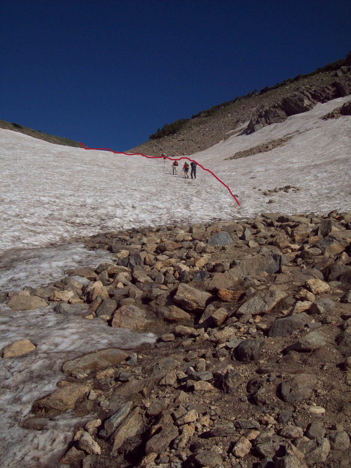 |
| Follow red line up Glacier for best route |
 |
| Josh, myself and the dogs on the peak |
Excellent photographs and commentary. Thanks for sharing
ReplyDelete