Monday, January 21, 2013

Palmer Lake Colorado, Hike the Reservoir Trail

Wow, in the entire time I've had this blog, I don't think its been this long since I've updated.  This fall and then winter were very busy for our family, my daughter turned 1, we had a barrage of visitors from out of state to visit her, then after they left it was holiday season and we were busy making gifts and decorating our house.  Then, just when things started to settle down, we all got sick.  And it wasn't just a little sick either, I ended up with pneumonia, Magnolia had 2 ear infections and a horrible cold and my husband also caught the mess and was sick himself.   The pneumonia was very bad and I ended up with complications that landed me in the hospital for 5 days.  It was miserable.   While I am not better yet, I'm getting there.
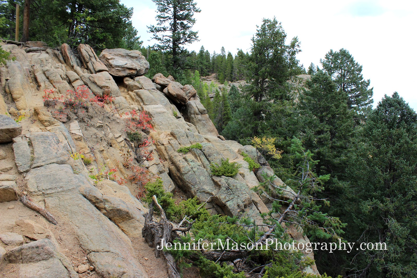
This hike was done back in November, before all the illness began.  We had planned on taking a small weekend getaway to Monument, Colorado and decided to hike the Palmer Lake Res Trail that took us to 2 reservoirs just outside of the town in the mountains.  

Thursday, November 29, 2012

Review of Cloud Rest Base Layer Top from Mountain Mama, Expecting Adventure


Several weeks ago I was given the opportunity to test out and review two items from one of my favorite maternity/nursing clothing companies, Mountain Mama Expecting Adventure. 
(let me set the record straight, I am not pregnant) 
Its been so warm in Colorado, and their Base Layer Top is so snuggly, that I haven't had the chance to properly hike in it, until our trip to Monument, Colorado last weekend. 

Several years ago I found Mountain Mama clothing on facebook and loved their style!  I wish that I could find non-maternity clothing this well made and comfortable, so I was super excited when they asked for ambassadors to try out both maternity AND nursing clothing and I was one of the few chosen to review.  Hurray for me! 

Wednesday, October 24, 2012

Coyote Ridge Natural Area, Loveland and Fort Collins, Colorado


Guest post from fellow blogger and father, Andy Hawbaker, you can check out his site here and more information at the bottom of this post.   

Coyote Ridge Natural Area is a wonderful spot for a fun family hike. My kids enjoyed seeing a snake, prairie dogs, and lots of birds. The Natural area is a City of Fort Collins Open Space located between Fort Collins and Loveland about 1 mile south of the Larimer County land fill. Visit the Larimer County Site for information about this trail.
This particular open space does not allow dogs and I have seen Fort Collins police ticketing people with dogs, so please leave the four legged ones at home.

Monday, October 15, 2012

My favorite Colorado hiking trails; need a hike suggestion?

Mt. Sniktau, Continental Divide
Lately I've been asked by several readers and a few hikers on the trail about which hike is my favorite and I'm always stumped by this question because I love so many trails for different reasons.  Some hikes I love because of the trail itself, maybe the scenery is great, or the hike ends in an awesome peak, lake, waterfall, arch or view that leaves me amazed.  Other hikes are memorable because of the way that I felt on the trail, maybe it was just a great day overall, or the hike was difficult and I felt accomplished when I completed it. 
After much thought on my part, I have included some of my favorite hikes and trails, they are my favorites for various reasons as well.  
The first trail I'd like to include (in no particular order) is Mt. Sniktau, which starts on the Continental Divide at Loveland Pass near the Eisenhower Tunnel.   This trail is at high elevation, starting at the top of the pass and my reason for listing this trail as one of my favorites is twofold.  First, I love looking at views while on the trail and I'd rather hike where I can see scenery than in a treed forest any-day.  Mt. Sniktau offers views in all directions including great views the Continental Divide; its also a high altitude hike which leads to a peak and when I reach a peak I always feel a sense of accomplishment.  But the reason that this trail stands out to me was because I was just having a great day on the trail. 

Thursday, October 11, 2012

Hiking a social trail in Coal Creek Canyon - Boulder Colorado

 The Flatirons are some of the most well known mountains visually, on the Front Range of the Rockies here in Boulder; the flat rock faces reflect the sunlight in the morning which creates a stunning glow and they are full of wildlife, scenic views, steep climbs and even an arch!  Today I stumbled across a trail that took me through a burn area on the southern end of the Flatirons near Coal Creek Canyon.  Before you read on, I must first say this trail was not marked and I just happened across it; there is no map or parking lot, I just stopped on the side of the road, parked and hiked.  As far as I could tell, the trail was on Open Space land and it lead to the train tracks that you can see from Hwy 93.  After hiking through the burn area, then up a steep hill and down toward the train tracks, then the path continued on a service road beside the railroad.   Eventually the road crossed over the tracks and at this point we turned around and went back.   I wondered if the trail was a social trail to get to the train tracks, for photos maybe?  Or maybe that is just my guess, because I love photography.  

Monday, October 1, 2012

Upper Maxwell Falls, Hiking in Evergreen Colorado

 The lower Maxwell Falls trailhead is one of the most popular on my website and I wanted to put up another post about it, this time I went to the Upper Maxwell Falls instead of the Lower Falls as I hiked here.  I actually hiked this trail mid-September, but am just now posting about it, the little lady keeps me so busy these days! 
 It took me about 10 minutes longer to reach the Upper Parking lot, there were 2 other cars in the small parking lot when I arrived on a cloudy weekday afternoon.  It took me a while to get Magnolia situated in her pack, and then we hit the trail.  Immediately, I was faced with 2 trails from the parking lot, since there is no formal map, I just chose left and started walking.  The trail is wide and continued through the forest and next to the stream.  Eventually the trail comes to another trail split, there is a trail sign here (although it was knocked down), and you could take the trail left and up to the Cliffs Loop or down/right toward the falls.  I decided that I wanted to check out both the Cliffs Loop (since I was not familiar with it at all) and the falls, so Magnolia and I took the Cliffs trail up for about 20 minutes and shortly after the split the trail continues out of the woods and you have views of the surrounding mountains which were full of fall color!   We hiked on this until we reached another trail split; I wasn't sure which way to go, and so we turned around to go back to Maxwell Falls.  

Friday, September 28, 2012

Pence Park, Hiking in Kittridge Colorado -- Where does this trail go?

Pence Park is not a well known park within the Denver Mountain Park System, but it connects to the Bear Creek Trail and is often used by mountain bikers now that the trail system connects from Pence Park to Lair O' The Bear, approximately 12 miles, the trail continues through Corwina Park as well, making it a shorter hike/bike if desired.  
I arrived at the park back in July when I first hiked this trail with Magnolia, the parking lot was empty and we went the opposite direction of the Lair O' The Bear Trail, it took us up into the woods and the trail was quite steep.  At one point it became so very steep that I decided it wasn't the safest idea carrying Magnolia on the front of me in the Ergo, so we turned around, went back to the parking lot and hiked down the Lair O' The Bear trail (another post on that hike to come).  I decided to go back to Pence Park with my husband because I just needed to know where the trail went!  

Wednesday, September 26, 2012

Getting out of the house, a Green Mountain Hike

Today is a day that I feel more like a mother than anything else.  A mama who is trying to work from home, part-time, while taking care of a very high energy baby who demands my time and protests loudly when she doesn't get what she wants.  Its hard.  I struggle.  
This week has been particularly hard, you can read more about that here if you'd like, but Magnolia is cutting a couple of teeth and when she is in pain, she just screams constantly despite whatever I try to do to give her relief.  Today, after a morning full of no naps and cranky-ness, I decided we needed to get out of the house; I grabbed the ergo and filled my camelback with some water and we jumped in the car to go to Green Mountain to find a trail.  
I had planned on hiking at a different trail, one that you can find on my blog here, but I missed my turn and ended up at the same trail that I hiked just days before Magnolia was born last November.  
When we first started hiking, Magnolia was very happy and we happily walked along, talked about the trees and birds, and she babbled about how much teething really hurts.  Of course, the happy mood didn't last long and soon she was fussing and squirming in the carrier, which quickly escalated into screaming.  We stopped and had a snack, which helped some, but eventually I had to put her back in the carrier so that we could hike back to the car.  She fussed and babbled throughout the hike back and even though her mood didn't really change, mine did.  I was able to get outside, do something that I like, and teach my child a little bit about nature in the process.   

Tuesday, September 18, 2012

Gary R. McDonnell Park, Lakewood Colorado, Playground with lots more

I've been visiting more parks than I normally would, now that Magnolia is here and at that age where she enjoys the playground a lot.  I grew up in Michigan, and there weren't any playgrounds near our house, you just had a swingset in your yard; and here in Colorado there is so much public space to enjoy and I would have loved this when I was a child.   However, I did have an amazing tree swing that my dad built, but no slide, rock wall, tree house, and more.   This park is well hidden from the road and probably wouldn't be found by someone who didn't know it was there.  

Monday, September 17, 2012

Hiking at Diamond Lake Trailhead, Indian Peaks Wilderness, Eldora Colorado

Buy this as an art print here
This weekend I really wanted to get out into the mountains with Josh, Magnolia and the dogs to see the fall colors, and I decided that we should hike the Diamond Lake trailhead outside of Eldora, Colorado.  This was a trail that Josh had mentioned he'd like to hike after I had hiked it solo back in 2010, you can see the report here.  At that time I hiked all the way to Diamond Lake and beyond.    Yesterday however, we only made it to the large falls with our whole family of hikers, baby and dogs, also both Josh and I have been feeling under the weather and that was plenty far enough for us on this day.  Even with only going about 2-3 miles round trip, the hike still took over 3 hours, we did stop often so that I could take pictures, we hiked slowly because we had Rock with us, our 14 year old dog, and Magnolia was pretty squirmy, so it we often had to attend to her needs.  We managed to loose another pacifier on the trail, but otherwise had a great afternoon.  The trailhead parking lot was completely packed and the trail was very busy.