 |
| Signs of spring blooming on along |
Getting there: White Ranch is a very large Open Space in Jefferson County; you can access the park from two separate entrances. I hiked from the east entrance this week; From Golden continue north on Hwy 93 toward Boulder about 1.7 miles outside of Golden. Turn left or west onto Pine Ridge Road; this is an easy road to miss, there is an Open Space sign immediately at the road turnoff; if you have reached the light at 58th Avenue, you have gone too far. Continue down Pine Ridge Road for about 1 mile, turn right at the stop sign into the Open Space Parking lot.
Specs: There are pit toilet restrooms, ample parking, and picnic tables with grills for an outdoor lunch after your hike. Click here for the Open Space website and here for the map; the bottom right of the map is the east entrance parking lot. *Of note* the map online is not presently updated accurately; due to trail erosion Open Space changed the trail route, the Belcher Hill Trail to the first trail intersection is not 1.7 miles, but is now 1.1 miles. The trail map at the park does reflect this change. Dogs must be on a leash, Open Space Rules apply.
The Hike: There were too many great pictures along this trail not to post my favorites; below is my photo journal of the hike. The route we took was the Belcher Hill trail 1.1 miles to the first trail intersection; then turned right and continued on the Whippletree Trail .6 miles to the next trail intersection. At that point I was getting tired so we started back down the trail for a 3.4 mile hike.
The start of the trail; it was a beautiful Wednesday afternoon; I love to hike with the clouds sitting on the mountains because you always see more animals, less people, and I think it looks almost magical in the fog.
***
Crab apple Blossoms and many other trees were blooming their spring flowers. Many had just started to bloom and will look beautiful after this weekend's rain and snow.
***
We saw a herd of 20+ deer and then a second herd of maybe 6 or 7 farther up the trail. The mountainside was tinted green from the recent rainfall. Very springlike for Colorado! Along this trail you will pass several huge houses, the first time we hiked here I thought one of them was a golf clubhouse, until I realized there was no golf course nearby.
***
I noticed a tiny birds nest in one of the bushes next to the trail; when the leaves grow in, this nest will be properly hidden, but until then, no bird would dare live here! It was very close to the ground.
***
There is a bridge and small creek along the trail about .4 miles or so into the hike; there isn't other water along the trail, so be sure to bring some for your dogs!
***
Looking back along the trail you can see North Table Mountain in the distance between the valley.
***
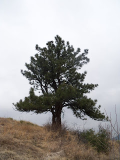
I love the clouds and fog behind the tree, the higher we climbed up the mountain, the cooler it got and we hiked into the clouds. The views along the trail after it intersects with the Whippletree Trail become more majestic and beautiful!
***
This photo opportunity presents itself at our turnaround point at the intersection of Whippletree Trail and the Longhorn Trail. From here we hiked back, it took us a little less than 2 hours, but I was hiking quite slowly, stopping often to take photos.
***
Rock loves to hike on a cool, cloudy day, its her favorite, can you tell?
***
More flowers along the trail, not sure of the name; does anyone know? I am terrible with the flora and fauna here in Colorado, I can't seem to find a good website with identifying photos.
***
More flowers in bloom :)
***
I'd love to hear your comments and/or suggestions for other hikes in the area!


Congratulations and Happy Mother's Day!
ReplyDeleteThanks Mike :)
ReplyDelete