
 Zapata Falls is a glacial waterfall in the Sangre de Cristo Mountains that freezes in the wintertime and thaws in the summertime; making it a tourist destination year round. We visited the falls this past weekend while it was still cold and frozen. The falls are located in a cave and to reach the cave, visitors must traverse walking on a frozen river and climbing over a smaller frozen waterfall. When we reached the river; we were shocked to see so many people struggling to climb over a 4 foot waterfall that was very slick. After watching everyone else for some time, I began to wonder if I could make it up myself, it was very slippery and cracking my head on the ice was not part of the plan this vacation. Crampons would have been very helpful for this climb! We managed to find a divot in the ice that we were able to use as a handhold to pull ourselves up. Once higher up on the river, you can walk into the cave with Zapata falls; it's well worth the struggle.
 Getting there: Zapata falls is located in Southern Colorado in the Sangre de Cristo Mountains near the Great Sand Dunes National Park and Monument. From Alamosa; the largest town nearby; head east on highway 160 for 15 miles to a well marked intersection.
Follow the signs for the Great Sand Dunes and turn north on highway 150 for about 10 miles. The falls are well marked with signs, but they are small signs compared to the Dunes. After about 10 miles on 150 make a right turn on an un-named County Road, this is well marked with a sign that points you to the falls. Drive about 4 miles up the dirt road to the parking lot. Our car was able to make it up the road just fine, but it is slow going, plan around 15 minutes to drive up the un-named road to the parking lot.
There is a bathroom in the parking lot, and several trails to hike along the 3.5 mile dirt road. From the parking lot for the falls there is another trail where you can hike up to a hidden alpine lake; but we were out of time, unfortunately. The Zapata falls trail and others are well marked. Click here for google map & to get your own directions.
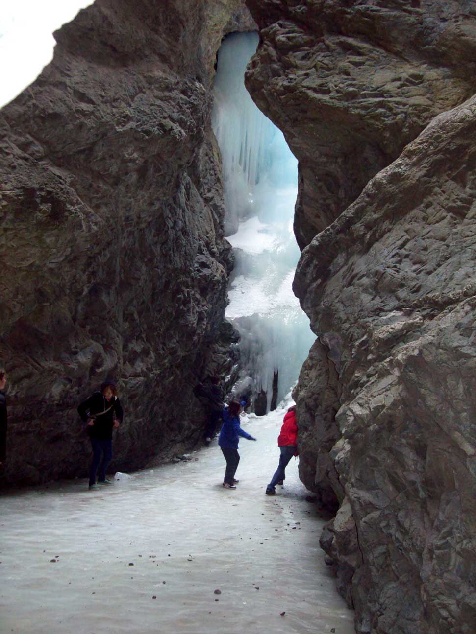
The Journey: We arrived on Saturday afternoon surprised to find a fairly crowded parking lot full of tourists. The parking lot itself provides a great view of the San Luis Valley and Sangre de Cristo Mountains. The falls are just a short .5 mile hike away; and after putting on our warm clothes, we started hiking. The trail is well maintained and wide for all skill levels to see the falls. Once we reached the base of the river the large crevace for the entrance of the cave is visible, but the beauty of the falls is inside the cave! This is where it gets a little tricky; the river is frozen solid and due to the cold water, it freezes quickly making it VERY slick. I grew up living on a lake in Michigan, but I have never walked on ice as slick as this! People were just falling left and right; it was comical but you didn't want to laugh too much, for fear of falling yourself. We cautiously walked the 50 yards into the opening of the cave and were greeted with a huge frozen waterfall inside the cave. Wow!
 Inside the cave tourists were walking cautiously on the ice toward the waterfall; taking pictures and trying not to fall. We were all gripping the walls of the cave for stability, kids were climbing up the fall; then falling down onto the ice, several were in tears.
 Josh and I took several pics and slid around on the ice, it was pretty cool. After a while we moved out of the cave and back out on the river; then we had to figure out how to get down the smaller waterfall we climbed up to get in. The solution to getting down: sit on your bottom and slide down the waterfall. It was really fun! Here is further NPS info about Zapata Falls.
There are other hikes along the road to reach Zapata falls, as well as at the parking lot for the falls. The South Zapata Falls Trail takes the hiker from the main parking lot to a high alpine lake, we tempted to hike it, but it was late in the afternoon and getting dark. If you have hiked the South Zapata Falls trail; I'd love to hear about the hike!
For directions; click the google map and input your address
View Larger Map
View Larger Map
No comments:
Post a Comment